
Future plans for Cape Town's unfinished highways
The unfinished highways of the Foreshore Freeway Precinct have been part of our pretty city’s landscape for nearly five decades and as a result have been the theme of many Cape Town myths and legends. It was in early June 2016 that we first heard some rumbles regarding the Foreshore Freeway Bridge (also known as Cape Town’s Unfinished Bridge which has been incomplete since the 1960s), and the possibility of it being connected to the road that runs onto the N1 to help alleviate congestion in the CBD.
In July 2016, the City of Cape Town released a document - The Development of the Foreshore Freeway Precinct - which called on investors and developers to provide solutions for the congestion and for affordable housing. The document was aimed at finding a bidder who, in return for the provision of road infrastructure, which would address numerous issues regarding traffic and access to the central business district, would be given access to develop the land under discussion.

There are six proposed ideas which have made it through the initial assessment phase, and De Lille expressed great enthusiasm around the possibilities of the project and the involvement of the residents to view these ideas.
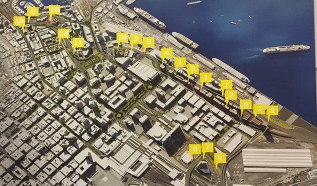
The six proposals were showcased at an exhibition hosted at the Cape Town Civic Centre until 21 March 2017. The exhibition was open to the public and here is a brief overview of each proposal:
Proposal A
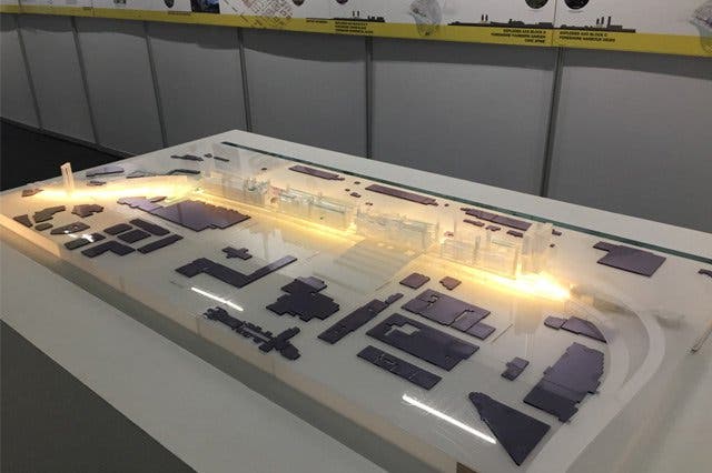
This proposal is aimed at creating an inclusive city by having a “powerful collaboration with the City of Cape Town” through their 15 key components. The components are listed as follows: removal of the Foreshore Freeway; addressing the current congestion issues; enhancing the existing MyCiTi Stations, as well as implementing two new stations; developing parking spaces in Durbanville; promoting cycling with routes to support it; creating express stations; creating attractive walking routes; building of park-and-ride stations which will be able to accommodate 2 000 cars; building an inclusive city by releasing land and removing the bridge which will, in turn, create a neighbourhood that will accommodate 15 000 people; designing open spaces with amenities and leisure spots; relocating public facilities and creating new ones and designing new urban parks.
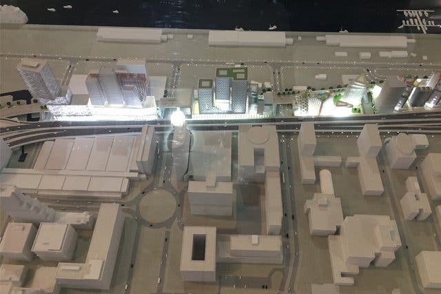
Aerial view of the proposal A
The 15 part component will provide 4 000 affordable residential units and important facilities that address major concerns in the city centre. The features include eight green spaces, nine urban squares, a school, a medical centre, a medical clinic, a counselling centre, three community halls and centres, 17 new inner-city leisure and sports fields and a world class urban park.
The aim is to create a highly livable and affordable housing neighbourhood with amenities in the city, and to create inner-city sport and leisure facilities for this neighbourhood. The new MyCiTi stations will alleviate congestion. The proposal will use the existing bridge in the city centre as a Garden Park bridge (urban park) for the public to use.
Proposal B
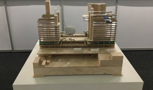
This proposal centres around an inclusive reimagining of the city centre. There are certain key principles that it focusses on such as mobility, housing and public transport. The aim is to address the mobility issue by unlocking urban connectivity with an improved infrastructure. It will aim to provide a multi-faceted mixed-use development with an iconic gateway element to reinforce Cape Town's status as a world city - connecting investments, residents, workers and tourists to it.
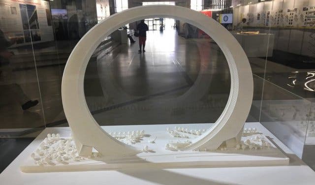
Image of proposal B's iconic tower
The bid includes tunnels for the freeway, with public transport and transport modal interchanges. It will build a world-recognised iconic tower and create up to 15 800 square metres of public space, 400 000 square metres of residential housing, which is 4 400 housing units - 1 000 of which are for the affordable housing markets. It also includes 95 000 square metres of commercial space and 20 000 square metres of retail with around 12 000 parking spaces as well as social and educational facilities and a public art program.
There are proposed mobility corridors, parking, bicycle, bus, train and podcar networks. The podcar network will be a new transport network and each car works with solar energy and holds 8 people in one sitting. The routes will include Sea Point railway and harbour routes, Signal Hill and Table Mountain routes, a V&A Waterfront route and a Mouille Point route.
Proposal C
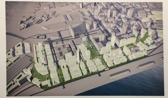
The heart of this proposal is the completion of the Foreshore bridge which means finishing the missing connectors at Helen Suzman Boulevard to connect with Buitengracht in order to alleviate the bottleneck congestion. The aim is to reuse the existing bridge structures; the CBD side viaducts, including the now completed section. This will accommodate the relocated traffic while the waterside viaduct can be put to alternate use.
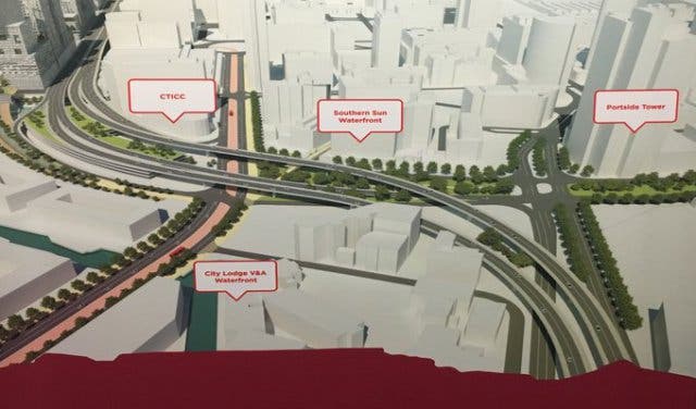
Aerial view of proposal C
The bid proposes to create a vibrant harbour front - providing a 24/7 urban activity ribbon along the entire harbour front. It projects that the completion of the two sections of the freeway will relieve the bottleneck congestion that is experienced. The sections are the city’s entrance from the N1/N2 freeways and the Walter Sisulu Road as well as Helen Suzman Boulevard.
A mobility system will create networks and routes for public transport, MyCiTi bus integration, pedestrian and cycling networks. It will utilise the current infrastructure of the bridges by converting the freeway to a boardwalk. The proposal is entirely eco-friendly and also includes developing inclusive housing, green landscaped courtyards, parking hubs and waterfront views.
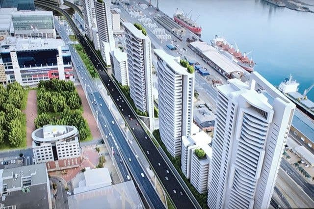
Projected view of proposal C's freeways
Proposal D
This proposal is aimed at, “reclaiming the Foreshore. A place for the people” where it suggests introducing the Foreshore as a city district for people. The urban design aims to shape the physical environment to facilitate urban life in all aspects. This leads to the creation of the Foreshore park; it links the Founders Gardens site, the Civic Centre Cape Town station and the MyCiTi service to the Foreshore and inner-city districts of Cape Town.
Side view of proposal D
The Harbour Walk will link the Royal Yacht Club and Culemborg City districts to the Convention Centre and the V&A Waterfront to create opportunities to link the new development and the city to Cape Town harbour. The aim is to create a city district for all and a mixed-use precinct that will address the desperate need for housing in the city. This contribution will result in a reduction in traffic and 70% of the residential development proposed for the Foreshore Park will be focussed on affordable housing options. The aim of the development is to create a smart city that is environmentally friendly and that incorporates all aspects of an all round Capetonian lifestyle in the city centre. The bid is focused on keeping sustainable living and keeping the Foreshore area within reach of all citizens.
Housing model for proposal D
Proposal E
This proposal looks at, “turning the problem upside down literally and figuratively” in a three-part solution - the city, the park and the movement. The CITYLIFT proposition states that they aim to drop the freeways to the ground and lift the city up over them creating and, “elevated berm”. The city will become the top layer; with an interactive space for 24/7 experiences where the CBD will comprise of commercial, residential and cultural facilities. The park will be the binding element as it will connect the layer above it (the city) and below it (transport).
The movement will be the ‘below’ section on ground level comprising of a 4-lane road in both direction, including MyCiTi transport lanes along with parking and other service infrastructure to support the development above. This section will have an interface with the harbour in future development.
Aerial projected view of Foreshore area for proposal E
This proposal sees a shift away from private cars to public transport. It proposes the creation of a multi-modal inner-city public transport loop system. There will be a new link for the N1/N2 to the V&A Waterfront via Duncan Road. The strategic MyCiTi rapid transit routes will have a corridor along the N1/N2 and a pedestrian mall linking harbour side with Founders Gardens, Artscape and the Civic Centre Station and the parade.
It will also create over 1 million square meters of development and through the layering indirectly enables at least another million. Nearly half of the housing will become affordable housing providing homes for working people such as nurses, teachers and those in service industries. There will be urban parks and an extended promenade from Sea Point to Milnerton.
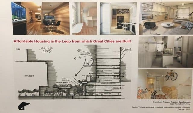
Proposal F
This proposal is focused on creating affordable housing units and making the city centre accessible and open to everyone. It aims to take the urban wastelands which runs rife in the city centre and turn them into dignified streets. It looks at making 450 affordable housing units stating that, “affordable houses is the level from which great cities are built”.
Projected aerial view of Foreshore area for proposal F
They suggest that there is room to finish the freeways as well as to develop between them - cutting the CBD traffic congestion by two thirds with no disruptions during the construction period. Mid-market funding will bring new freeways and subsidise new affordable neighbourhoods fostering social and economic mobility.
The aim is to bring the people back into the city. The proposal has its roots in creating an affordable city and life for all, diversifying the city centre and opening up the markets in the city to all Capetonians.
Projected view of housing for proposal F
These proposals were put forward in answer to The City of Cape Town Mayor Patricia de Lille’s announcement that in her tenure as mayor she will finally resolve the issues surrounding the unfinished bridge and that she, “would like it to be part of [her] legacy.” With this being said she stated that the Foreshore Freeway Project is one of the five transit-orientated development (TOD) projects which will see economic and residential development located closer to transport corridors.
“To deal with apartheid, spatial planning and urbanisation, we need to be innovative and forward-thinking to make this great city even greater[...] this is the beginning.” de Lille stated.
The city is starting with the TOD projects in the city centre and will attempt to follow this approach with other developments namely; Paardevlei, Athlone, Bellville and Philippi where there will be a community involvement in the redesign.
The TOD strategic framework aims to reverse the legacy of apartheid’s spatial planning and redress the injustices of the past by stopping long travelling distances and urban sprawl and bringing people closer to residential and work opportunities.
The increase in traffic and pressure on the current highways far exceed that of the 1970’s and thus action is being taken, to alleviate the congestion in and out of the city.
Apart from the aesthetic problem of the half-built freeway, de Lille acknowledges that it is preventing the development of prime City-owned land - the Foreshore Freeway Precinct.